ESCURSIONE A PUNTA LA MARMORA – DOMENICA 5 OTTOBRE 2014EXCURSION TO PUNTA LA MARMORA – SUNDAY OCTOBER 5,2014
 ESCURSIONE PUNTA LAMARMORA (GENNARGENTU)
Adesioni entro venerdi 3 ottobre ore 21
cell: Leonella 3479437675/ G.Paola 3478598668
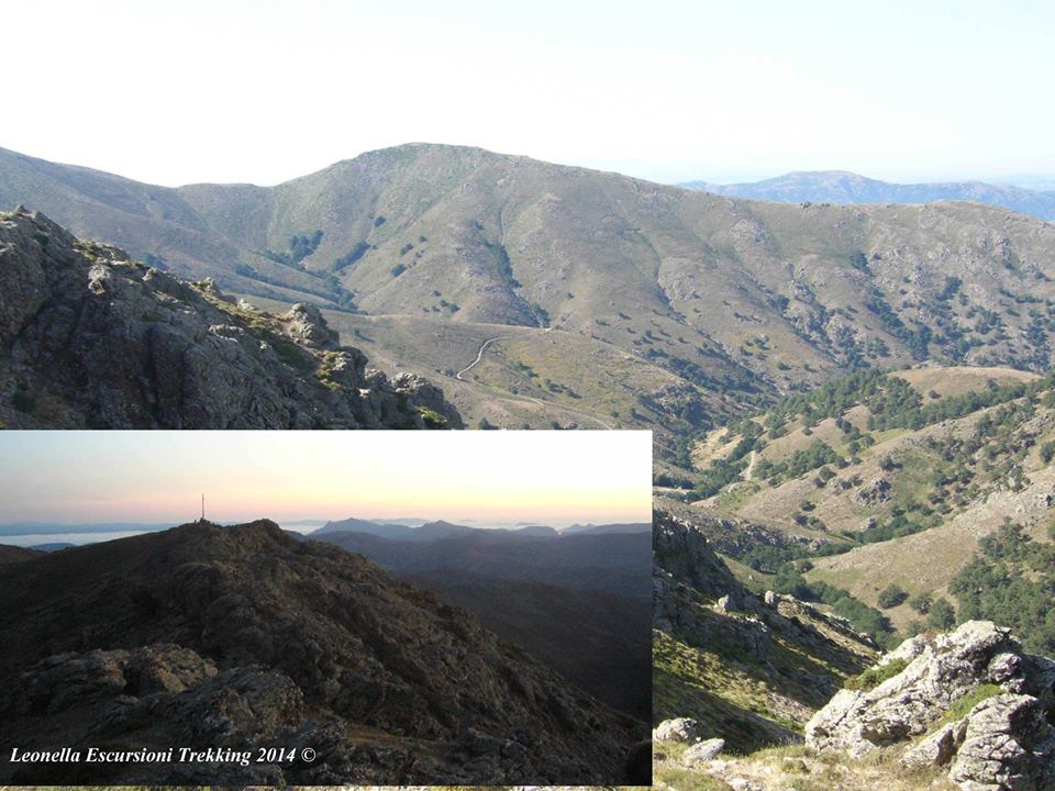
Zona geografica Gennargentu Sardegna Centro-Occidentale, la montagna più alta della Sardegna. Gennargentu “Porta D’Argento”, in riferimento alle sue rocce scistose che luccicano come l’argento.
Sentiero molto frequentato dagli escursionisti, attraverseremo panorami suggestivi che ci porteranno sulla vetta più alta dell’isola.
Da Cagliari 140km, da Sassari 130km, da Oristano 87km, da Nuoro 76km.
Itinerario: E (Escursionistico)
Dislivello: 300 m
Tempo di percorrenza a piedi andata: 3 ore
Tempo di percorrenza a piedi rientro: 2.30 ore
Lunghezza del percorso A/R: 14.5 km
Arrivo sul posto con auto propria
Alcuni utili consigli:
Pranzo al Sacco: a carico dei partecipanti
acqua circa 2 litri ,un abbigliamento escursionistico adeguato, scarponi da trekking
non esitate a fare delle domande,a chiamarci per confermare la vostra partecipazione e avere tutte le informazioni e maggiori dettagli
Per informazioni cell:
3479437675 su facebook Leonella Melis Escursioni Trekking
3478598668 G.Paola Arru, su facebook pagina di (Geoturismo Sardegna)
Adesioni entro il 3 ottobre
Entrambe Guida Ambientale Escursionistica iscritte al Registro Regionale della Sardegna, associate AIGAETRAVEL TIP LAMARMORA (GENNARGENTU)
Entries by Friday, October 3 at 21
cell: Leonella 3479437675/3478598668 G.Paola
Geographical area Gennargentu Sardinia Central-West, the highest mountain in Sardinia. Far too much “Porta D’Argento”, in reference to its shale that shine like silver.
Path much frequented by hikers, cross beautiful landscapes that will lead us on the highest peak of the island.
From Cagliari 140km, 130km from Sassari, Oristano from 87km, 76km from Nuoro.
Itinerary: E (Hike)
Difference in altitude: 300 m
Time Walk Forward: 3 hours
Time Walk back: 2.30 hours
Length of route A / R: 14.5 km
Check on site with own car
Some useful tips:
Packed lunch: a load of participants
about 2 liters of water, a suitable hiking clothes, hiking boots
do not hesitate to ask questions, to call us to confirm your participation and have all the information and details
For information cell:
3479437675 on facebook Leonella Melis Hikers
3478598668 G.Paola Arru, facebook page (Geotourism Sardinia)
Entries by October 3
Both Environmental Guide registered in the Registro Regionale della Sardegna, associated AIGAE


Leave a Comment
You must be logged in to post a comment.
